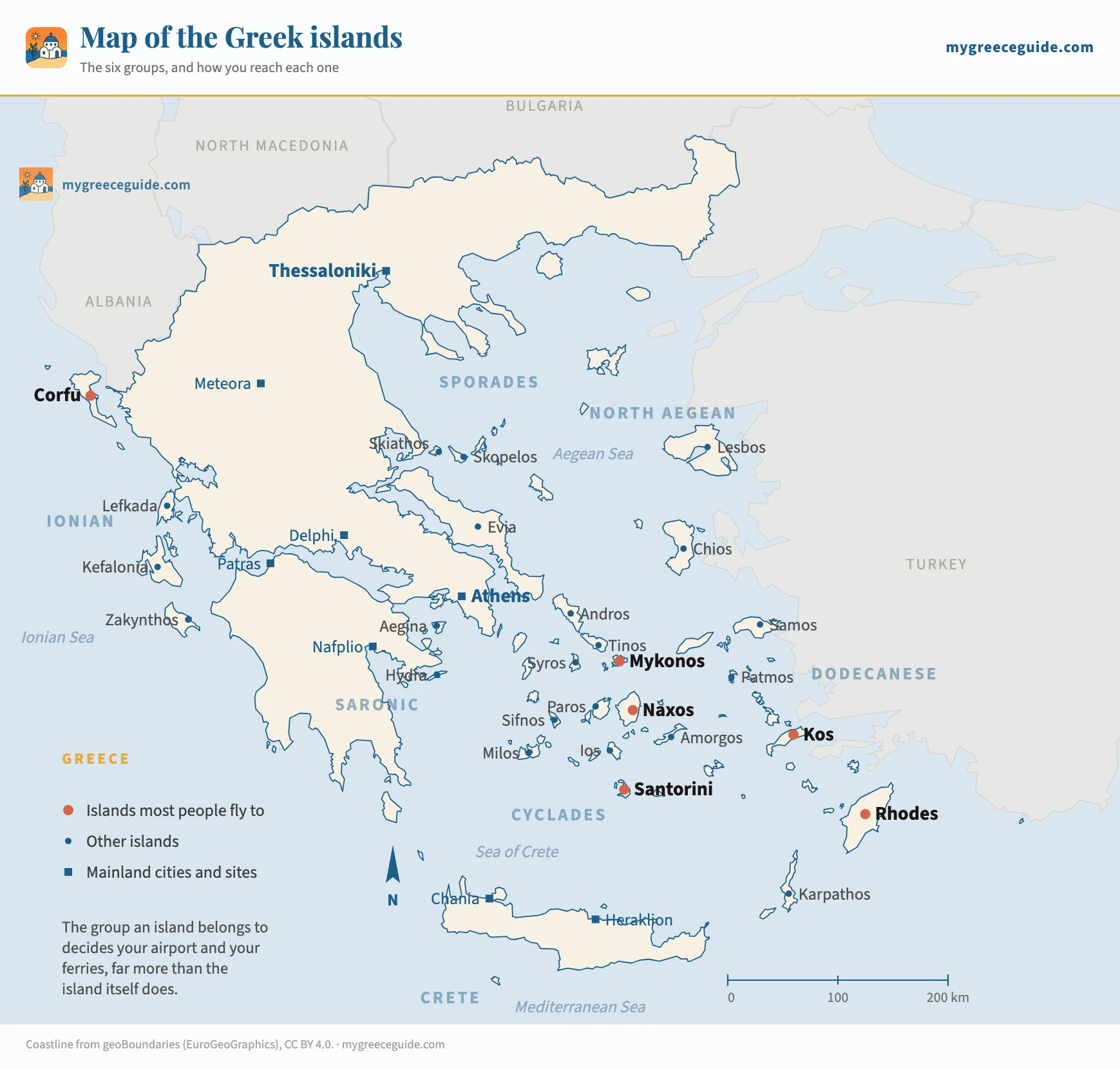
Map of the Greek islands: the six groups that decide your trip
There is no such thing as the Greek islands. There are six groups scattered across two different seas, and the group you pick settles your airport, your ferry port and which other islands you can realistically add.
Every island below sits at its real coordinates. That is worth saying because most maps of the Greek islands are either a satellite tile you cannot read or a postcard with eight names on it, and neither tells you the thing that costs money to get wrong: Corfu and Santorini are on opposite sides of the country, and no ferry joins them.
The islands
The six island groups, and what each one commits you to
Greece divides its islands into six groups plus Crete, which is large enough to be treated as a region of its own. The grouping is not decorative. It follows the ferry networks and the airports, so choosing a group is really choosing how you arrive, how long the journey takes and what else you can reach once you are there. Pick the island first and you can end up with a five hour transfer you did not budget for.
Pick a group to see its airports and ferry ports
Which group are you looking at?
The white and blue ones, in the middle of the Aegean, and the only group where island hopping is genuinely easy.
- Main islands
- Santorini, Mykonos, Naxos, Paros, Milos, Ios, Syros, Sifnos, Folegandros, Amorgos
- Airports
- Santorini (JTR), Mykonos (JMK), Naxos, Paros, Milos, Syros
- Ferry port
- Piraeus for most of the group, Rafina for Andros, Tinos, Mykonos, Naxos and Paros
- From Athens
- 2 h 15 to Mykonos by fast ferry, 5 h to Santorini, 8 h on a conventional boat
- Season
- April to late October, thin in winter
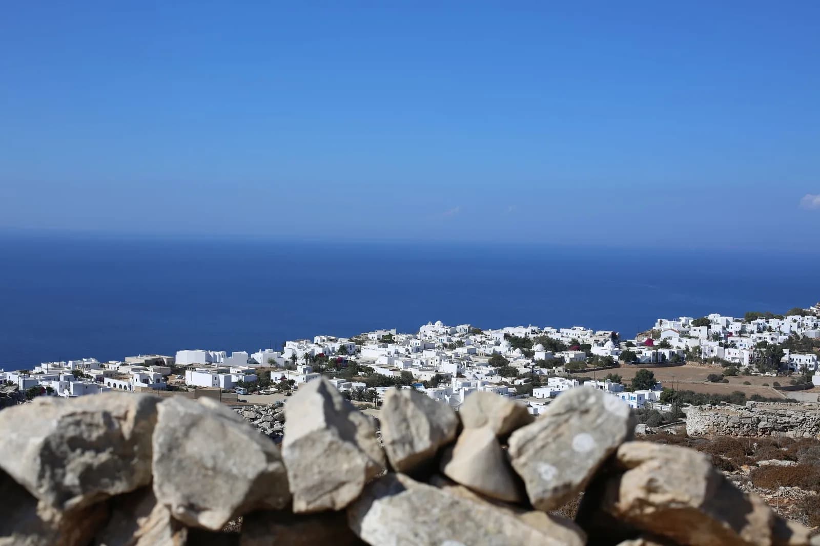
Bare rock, low white villages and very little shade. The islands sit close enough together that a boat between two of them takes an hour or two, and in July and August there are several a day. The meltemi blows hard from the north in those same two months, which cancels sailings on the exposed western routes more often than people expect.
What it pairs withCombines with itself in any order, with the Saronic islands because both leave from Piraeus, and with Crete through the Santorini to Heraklion boat.
The six groups side by side
The same six, compressed into the four things that separate them. Travel times are for the fast ferry or the direct flight, outside the days either side of 15 August when the whole country moves at once.
| Group | Where it sits | Way in | From Athens | Island hopping |
|---|---|---|---|---|
| Cyclades | Middle of the Aegean | Santorini, Mykonos, or Piraeus by boat | 2 h 15 to 8 h | Easy, several boats a day in summer |
| Ionian | West coast, facing Italy | Corfu, Kefalonia, Zakynthos, Preveza | 1 h by air, 4 h 30 by road | Easy within the group, impossible outside it |
| Dodecanese | Along the Turkish coast | Rhodes or Kos | 1 h by air, 12 h by sea | Good in summer, thin in spring and autumn |
| Sporades | Off the east coast, north of Evia | Skiathos, or Volos by boat | 5 h door to door by road and ferry | Easy between the three main islands |
| North Aegean | North-east, close to Turkey | Mytilene, Chios, Samos | 50 min by air, 7 to 12 h by sea | Limited, most routes run back to Athens |
| Saronic | In the gulf outside Athens | Piraeus, no airport | 40 min to 2 h | Easy, and a day trip is realistic |
Which groups combine, and which do not
Two islands can look like neighbours on a map of Greece and still have no boat between them. Ferry routes radiate out of Athens instead of joining the groups sideways, which is why the answer nearly always comes down to the group rather than the distance. These are the pairings people ask about.
- Cyclades and CycladesYes
- The whole point of the group. Naxos to Santorini, Paros to Milos, Mykonos to Naxos: an hour or two each, several times a day from June to September.
- Cyclades and SaronicYes
- Both leave from Piraeus, so a couple of days on Hydra either side of a Cyclades week costs one short boat and no backtracking.
- Cyclades and CreteYes
- Santorini to Heraklion takes about two hours by fast ferry and runs daily in summer. It is the one southern link that behaves like a Cyclades hop.
- Cyclades and DodecaneseOnly in summer
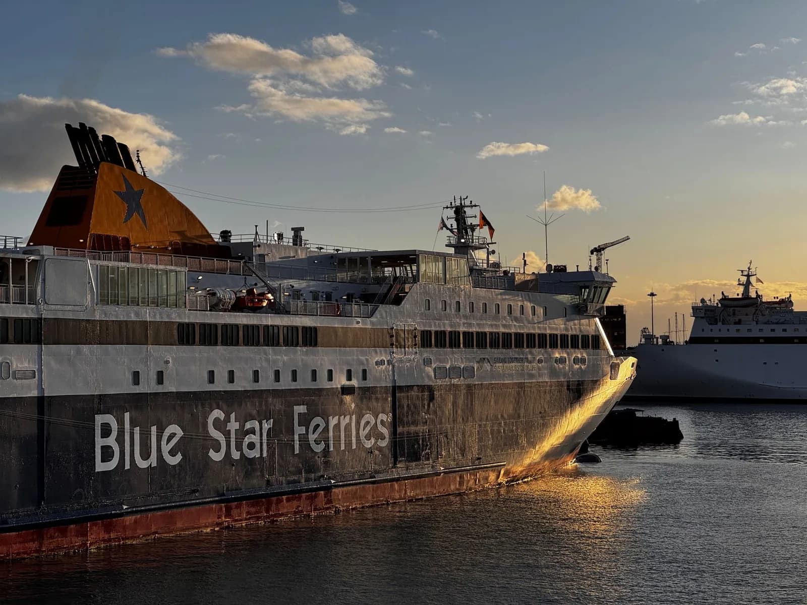
- The Blue Star route from Piraeus through Naxos and Amorgos down to Kos and Rhodes runs a few times a week between June and September. Outside that window you fly back through Athens.
- North Aegean and DodecaneseOnly in summer
- Samos to Patmos is a short crossing and connects the two chains, which makes a Samos plus Patmos plus Kos trip work. It is a thin schedule and worth checking before booking either end.
- Sporades and CycladesNo
- They look close on a map of the Aegean and there is no boat between them. Skiathos to Mykonos means a ferry to Volos, three hours to Athens, then a ferry out of Piraeus or Rafina.
- Ionian and anything AegeanNo
- The Ionian sits on the far side of mainland Greece. Corfu to Santorini is two flights or a full day of driving and ferries, and no amount of planning shortens it.
- Ionian and IonianYes
- Kefalonia, Ithaca, Lefkada and Zakynthos are linked by short local boats, and Lefkada is joined to the mainland by a causeway you can drive across.
Where the islands people name actually are
If you arrived here after seeing one island on a hotel page, this is the line you want. It places the island in its group, which tells you the rest.
| Island | Group | Where it is | Airport | By sea |
|---|---|---|---|---|
| Corfu | Ionian | Top of the west coast, 2 km off Albania | CFU | Ferry from Igoumenitsa, 1 h 30 |
| Kefalonia | Ionian | Largest of the Ionian islands, west of Patras | EFL | Ferry from Kyllini to Poros, 1 h 30 |
| Zakynthos (Zante) | Ionian | South of Kefalonia, the last Ionian island of any size | ZTH | Ferry from Kyllini, 1 h |
| Lefkada | Ionian | Between Corfu and Kefalonia, against the mainland | PVK at Preveza | Causeway, the one island you drive onto |
| Santorini | Cyclades | Southern edge of the Cyclades, a flooded volcanic caldera | JTR | Fast ferry from Piraeus, 5 h |
| Mykonos | Cyclades | North-east Cyclades, next to Tinos and Naxos | JMK | Fast ferry from Rafina, 2 h 15 |
| Naxos | Cyclades | Centre of the group, and the largest island in it | JNX, small aircraft only | Ferry from Piraeus, 3 h 30 to 5 h 30 |
| Milos | Cyclades | South-west corner of the Cyclades | MLO, small aircraft only | Ferry from Piraeus, 3 h to 7 h |
| Rhodes | Dodecanese | Bottom of the Turkish coast, 18 km off Marmaris | RHO | 1 h flight from Athens, or overnight by sea |
| Kos | Dodecanese | Halfway up the Dodecanese, 4 km off Bodrum | KGS | 1 h flight from Athens, ferry on to Rhodes |
| Skiathos | Sporades | Off the east coast of the mainland, north of Evia | JSI | Ferry from Volos, 1 h 15 on the fast boat |
| Hydra | Saronic | In the gulf south-west of Athens | None | Fast boat from Piraeus, 1 h 50 |
| Crete | On its own | The southern boundary of the Aegean, and the largest island in Greece | HER and CHQ | 1 h flight, or 9 h overnight from Piraeus |
Zante and Zakynthos are the same island, which trips people up on booking sites: Zante is the Venetian name and still the one the airlines use. Kefalonia is sometimes spelled Cephalonia, and Corfu is Kerkyra on Greek timetables. The three of them belong to the green group on the west coast, within sight of each other, and none of them is anywhere near the white villages most people picture when they say Greek islands.
The islands people are actually picturing
Those three are worth separating properly, because the names shift on booking sites. Shipwreck Beach sits on the north-west cliffs of the southernmost of them, an hour's drive and then a boat from the resorts most people book, which is the standard disappointment of a Zante week. Kerkyra, at the top of the chain, is the one with the Venetian old town and the 3 km channel to Albania. And the runway on Kefalonia sits near Argostoli in the south, so the drive up to Fiskardo at the far tip takes an hour and a half whatever the hotel photograph implies.
The ports and airports that do the work
Athens has three ferry ports, not one, and the difference matters when you land at 6 pm with a boat at 7.30. Piraeus is the big one, half an hour by metro from the centre, and it serves the Cyclades, the Saronic islands, Crete, the Dodecanese and the North Aegean. Rafina is smaller, closer to the airport than to the city, and it runs to Andros, Tinos, Mykonos, Naxos and Paros. Lavrio is further south and handles a short list of Cyclades routes.
The Ionian islands use none of them. Corfu goes from Igoumenitsa on the north-west coast, Zakynthos and Kefalonia from Kyllini in the Peloponnese, Ithaca from Patras. All three are four to six hours from Athens by road, which is why almost everyone flies into Corfu, Kefalonia, Zakynthos or Preveza instead. The Sporades work the same way from Volos and Agios Konstantinos on the east coast, which is why a Skiathos trip is usually flown rather than sailed.
Piraeus is the busiest passenger port in Europe and the gates run from E1 to E12 along about two kilometres of quay, so the gate number on your ticket is not a detail. Give yourself an hour if you are arriving by metro in August.
One gate out of twelve
The Dodecanese skip Athens altogether for most visitors, because Rhodes and Kos both take direct flights from northern Europe well into the autumn. They are laid out very differently, though. Rhodes puts its walled medieval town at one end and Lindos 50 km down the east coast, so the choice of resort decides how much driving your week contains. Kos is a 45 km strip you can ride a bike along, with the town at the eastern tip and the beaches at the other end, and KGS dropped in the middle of the island about 25 km from either, which is the one transfer worth checking before you book. The other thing this group has and no other does is a second country within sight: the crossings to the Turkish coast are drawn on the group map with the distance and the sailing time for each one.
How many Greek islands are there, really
The figure you see quoted is 6,000, which counts every rock and islet in Greek territorial waters. Count only what has a name and a coastline of any size and you land nearer 1,200. Around 227 have permanent residents, and of those maybe 80 have an airport, a scheduled ferry or enough rooms to show up on a booking site. So the map that matters is much smaller than the number suggests.
Crete accounts for a quarter of the island land area on its own, at 8,336 km², and holds mountains above 2,400 m. Evia, the second largest, is joined to the mainland by a bridge at Chalkida and barely registers as an island to the people who live there. After those two the drop is steep: Rhodes, Lesbos, Chios, Kefalonia and Corfu are the only others above 600 km².
Reading the map before you book
Three checks catch most of the trouble. Find your island on the map above and note which group it belongs to. Check whether the second island on your list is in the same group, and if it is not, look for the pairing in the table further up before assuming a boat exists. Then check which Athens port your route uses, because Piraeus and Rafina are an hour apart in traffic and the ticket does not always say which one you want.
The group answers the rest on its own. It tells you which airport the cheap flights land at, whether the boat runs in May, and how many islands you can sensibly fit into ten days. Skip the check and the usual outcome is a taxi across Athens at seven in the morning to a port that was never on your ticket.
Questions people ask about the Greek islands
What is the nicest Greek island to go to?
It depends entirely on which group you can reach and what you want from the week. For a first trip, Naxos is the safest answer in the Cyclades: sandy beaches on the west coast, mountain villages inland, a real town rather than a resort, and ferries in every direction. Milos for the beaches, which are geological rather than sandy. Paros for hopping, because everything passes through it. Rhodes or Kos if you want a season that runs into November. Corfu if you want green and Venetian. Crete if you want all of it and a car.
Which Greek islands should you stay away from?
None outright, but three kinds catch people out. The package nightlife strips, Malia on Crete, Kavos on Corfu, Laganas on Zakynthos and Faliraki on Rhodes, are excellent at one thing and dismal at everything else. Santorini and Mykonos in August, where the crowding is real enough that the Greek government has moved to limit cruise arrivals and charge a levy on them, and where prices run double the neighbouring islands. And any small island in April or October, when the ferry drops to two or three a week and half the tavernas are shut.
Which Greek islands have airports?
About thirty of the 227 inhabited islands, and only a dozen take direct flights from northern Europe. Those are Crete with two, Heraklion and Chania, then Rhodes, Kos, Corfu, Zakynthos, Kefalonia, Mykonos, Santorini, Samos, Lesbos, Skiathos and Karpathos. Naxos, Paros, Milos, Syros, Ikaria and Astypalea have runways served from Athens only. Lefkada has none and uses Preveza on the mainland, twenty minutes away over the causeway, which is why it appears in flight searches at all.
How many Greek islands are there, and how many are named on a map?
The figure quoted is 6,000, which counts every rock and islet in Greek waters. Count only what has a name and a coastline of any size and you land nearer 1,200. Around 227 have permanent residents, and of those roughly 80 have an airport, a scheduled ferry or enough beds to appear on a booking site. So a map with names on it shows a few dozen places, not thousands, and that shorter list is the one that matters when you are planning.
Which Greek islands are closest to Athens?
The Saronic islands, in the gulf immediately outside the city. Aegina is 40 minutes from Piraeus on the fast boat, Poros about an hour, Hydra 1 h 50 and Spetses just over two hours. None of them has an airport because none of them needs one, and Aegina in particular works as a day out. After those, the nearest Cyclades are Kea, an hour from Lavrio, and Andros, two hours from Rafina.
