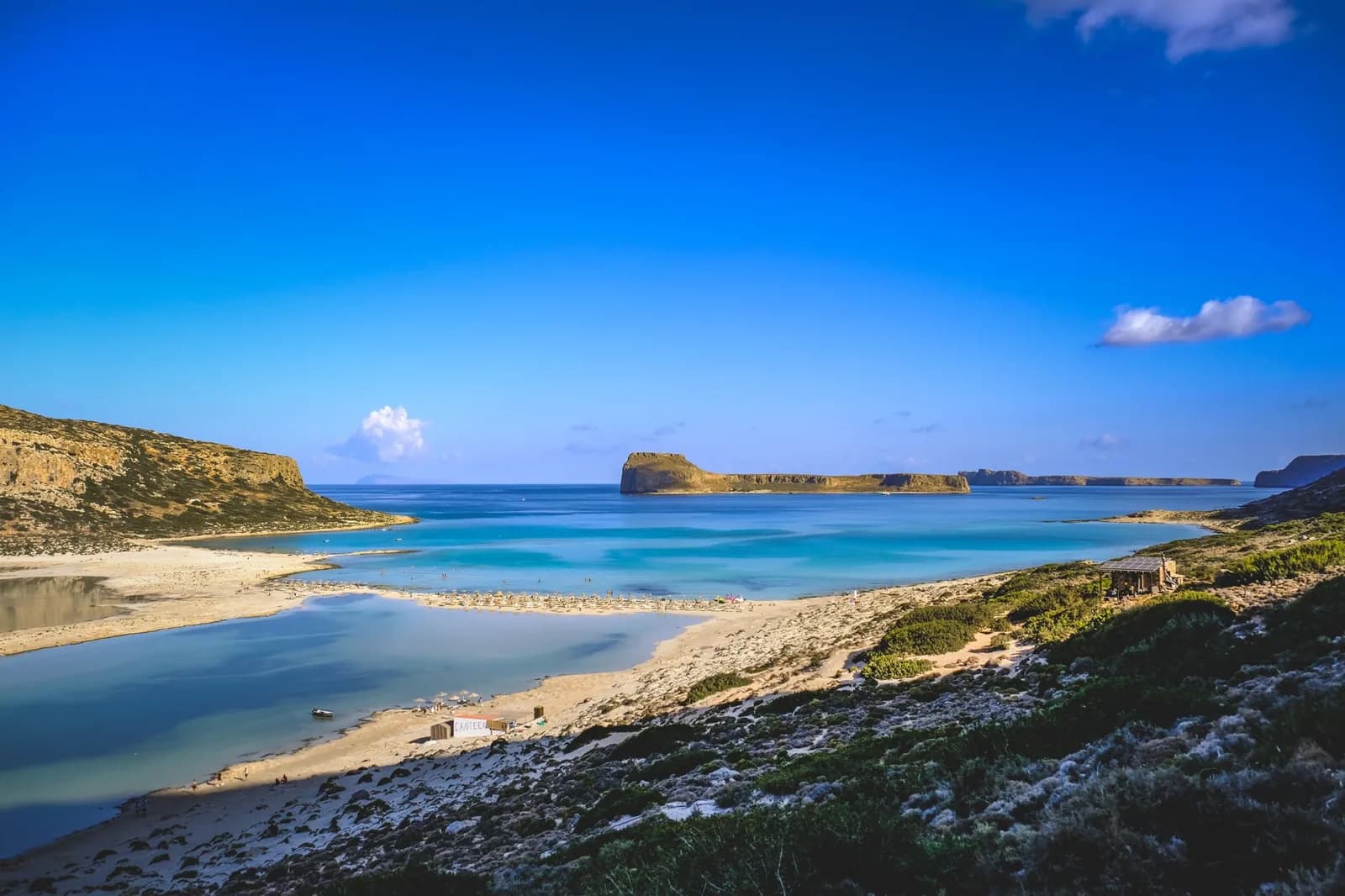
Crete map: where everything is on the island
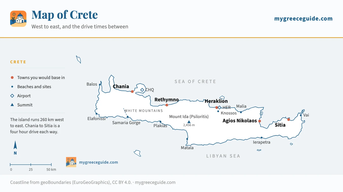
Crete is 260 km from end to end, and that single number is behind most of the trips that go wrong here. Balos and Elafonissi are at one end, Vai is at the other, and Knossos is in the middle. Four hours of driving separates the first from the second.
Look at Crete on a map of Greece and it reads as one island among many. Look at it on its own and the proportions change: a ribbon 260 km long and 12 km wide at its narrowest point, with a spine of mountains running the whole way and two coasts that behave like different countries. Which end you book decides most of the trip, and the island splits into four regions that each answer a different kind of holiday. Everything below is placed from its real coordinates, so the distances on the page are the distances on the road.
The island
The island, west to east
Four towns hold the island together, and they are strung along the north coast in order. Chania in the west, under the White Mountains, with a Venetian harbour and the lighthouse that appears on half the covers of every Crete guidebook. Rethymno 60 km on, smaller, with a fortress and a long town beach. Heraklion in the centre, the capital, the port and the airport most flights land at. Agios Nikolaos another 65 km east, on the Gulf of Mirabello, where the island narrows to 12 km and the crowds start to thin.
The south is a different island. There is no continuous coast road, the villages are reached by dropping over the mountains from the north, and a few of them still have no road at all. Agia Roumeli, where the Samaria gorge comes out, is served only by boat. Loutro, along the coast, is the same. That is the reason the south stays quiet in August while Chersonisos does not.
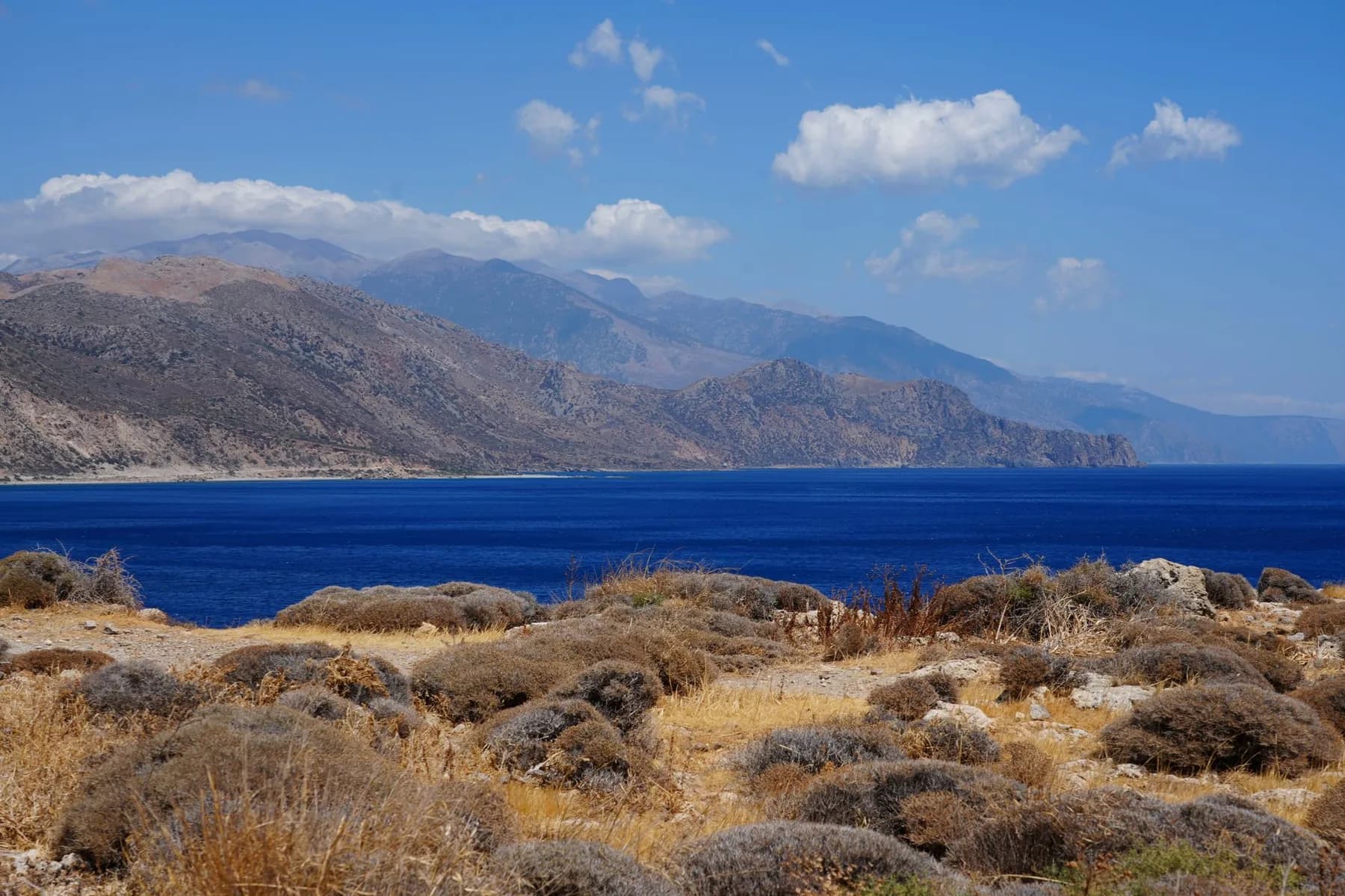
Between the two coasts sit three massifs: the White Mountains behind Chania, Psiloritis in the centre at 2,456 m, and Dikti above the Lasithi plateau in the east. They hold snow into May, which is worth knowing if you are planning an April trip around a gorge.
The spine
Which base to choose
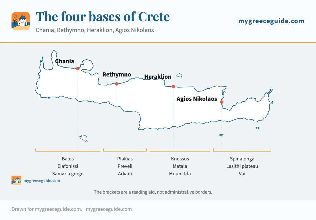
The honest answer is that Crete does not have one. Pick the base that sits nearest the thing you most want to see, and accept that the other end of the island is a separate trip or a second hotel.
The four towns do not offer the same kind of room, either. Chania and Rethymno put you in restored Venetian houses inside the old quarters, Heraklion is business hotels near a working port, and the east is resorts on the water. It is worth reading what each stretch of coast charges for a bed before you settle the base, because the cheapest week is rarely in the town you first thought of.
The four bases
Say what you came for and the bases follow
What did you come to Crete for?
The two beaches on every Crete postcard sit at the far western end, within 80 km of each other and 250 km from Sitia.
Chania
North-west coast, on the Venetian harbour
- Airport
- Chania (CHQ), 20 min
- Balos car park
- 1 h 20
- Elafonissi
- 1 h 40
Both beaches are day trips from the same bed, and the old town gives you somewhere to eat when you get back. Nothing else on the island comes close for the west coast.
The catchThe last 8 km to Balos is an unsurfaced track that most rental contracts exclude. The boat from Kissamos is the usual answer.
How far everything really is
These are driving times outside July and August. The north coast road between Chania and Agios Nikolaos is fast and mostly dual carriageway. Everything that leaves it slows down, and mountain roads take longer than the kilometres suggest.
| From | To | Distance | By car | Worth knowing |
|---|---|---|---|---|
| Chania airport (CHQ) | Chania | 15 km | 20 min | Bus into town every 30 min in summer |
| Chania | Balos car park | 55 km | 1 h 20 | Last 8 km unsurfaced, or take the Kissamos boat |
| Chania | Elafonissi | 75 km | 1 h 40 | Mountain road, slower than the distance suggests |
| Chania | Omalos (Samaria) | 45 km | 1 h | Buses leave at 6 am for the gorge |
| Chania | Rethymno | 60 km | 50 min | The fast stretch of the north coast road |
| Rethymno | Plakias | 35 km | 45 min | Over the ridge to the south coast |
| Rethymno | Heraklion | 80 km | 1 h 05 | Straight run, tolls free |
| Chania | Heraklion | 140 km | 2 h | The transfer people book by mistake |
| Heraklion airport (HER) | Heraklion | 5 km | 15 min | City bus, or 15 euros by taxi |
| Heraklion | Knossos | 5 km | 15 min | City bus number 2 from the port |
| Heraklion | Matala | 70 km | 1 h 15 | South coast, across the Messara plain |
| Heraklion | Agios Nikolaos | 65 km | 50 min | Fastest stretch on the island |
| Agios Nikolaos | Ierapetra | 40 km | 40 min | Across the narrowest point, 12 km wide |
| Agios Nikolaos | Sitia | 70 km | 1 h 15 | Winding coast road above Mirabello |
| Sitia | Vai | 25 km | 30 min | The palm beach, and the end of the road |
| Chania | Sitia | 265 km | 4 h 15 | End to end. Not a day trip in either direction |
Two rows in that table catch people out. Chania to Heraklion at two hours is the transfer booked by anyone who finds a cheap flight into the wrong airport. And Chania to Elafonissi at an hour and forty, for 75 km, is what a Cretan mountain road does to an average speed.
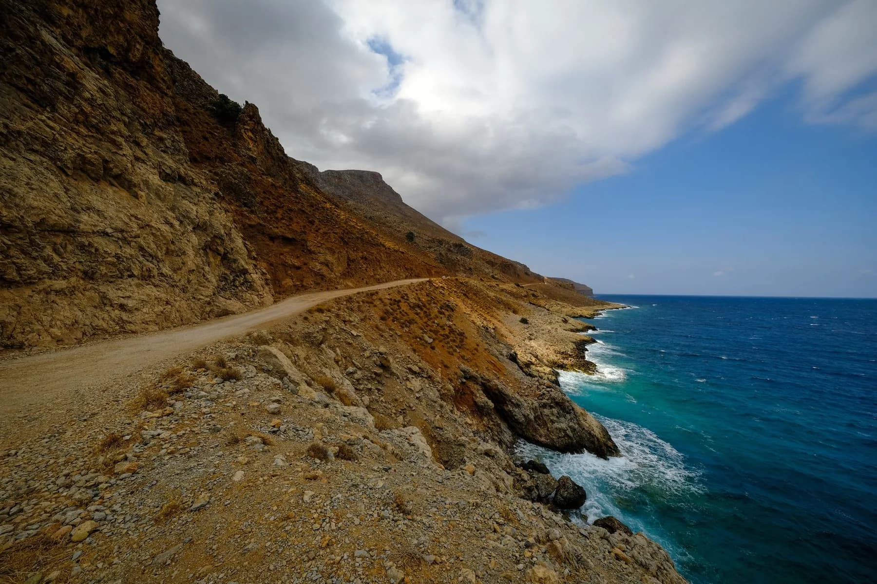
What 45 km an hour looks like
The two airports, and which one to book
Heraklion (HER) is the busier of the two by a wide margin and sits 5 km east of the city, which puts it within an hour of Knossos, Agios Nikolaos, Rethymno and Matala. Chania (CHQ) is on the Akrotiri peninsula, 15 km from Chania town, and it is the one to want if your week is built around the west. Sitia has a third airport, but it handles a handful of domestic flights and can be ignored unless you are going to Vai and nothing else.
The two arrivals halls behave differently on the ground. Landing at HER means a busy single terminal with a bus into the city every twenty minutes and taxi fares that are fixed by zone, while the small terminal out on Akrotiri has one bus line, timed to the flights rather than to a clock, and a fifteen minute drive into town. If you land after eleven at night, check which of the two you are landing at before you assume there is a bus.
Both airports have the same problem in summer: the car hire desks run out. Crete takes more visitors than any Greek island except Rhodes, and the fleet does not stretch in August. Booking a car two months ahead costs less than booking it two weeks ahead, and in the last week of July it may be the difference between a car and a bus timetable.
Where Crete is in Europe
Crete closes the southern edge of the Aegean, which is why it has been fought over for three thousand years. It is the largest Greek island and the fifth largest in the Mediterranean, after Sicily, Sardinia, Cyprus and Corsica. Athens is 319 km north, Santorini 121 km, Rhodes 304 km to the north-east. The Libyan coast is 379 km south, which means the sea between Crete and Africa is barely wider than the sea between Crete and the mainland it belongs to.
Where Crete sits
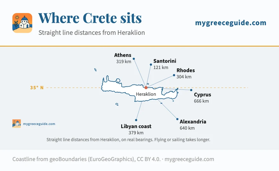
That latitude is why the season runs longer here than anywhere else in Greece. The sea is swimmable from May to late October, the south coast around Ierapetra stays warm into November, and the gorges open weeks before the ones in the Peloponnese. It is also why July and August on the south coast are properly hot, and why the Cretans themselves go up to the mountain villages when they can.
Those distances also decide how you get here without flying. The overnight boat out of Piraeus covers the 319 km to Heraklion or Chania in about nine hours in a cabin, which turns the journey into a night of accommodation rather than a day of your holiday. Santorini is the other one people try, and the fast catamaran north across the 121 km takes under two hours in good weather and gets cancelled outright when the meltemi blows, so it is not the crossing to put on the morning of your flight home.
Knossos is the one site on the island where the difference between reading a sign and having someone explain the thing in front of you is total. The palace was excavated and then partly rebuilt in concrete by Arthur Evans a century ago, and almost nothing on site tells you which walls are Minoan and which are his. Book the morning slot: by noon in summer there is no shade on the west court.
Questions people ask about Crete
Which part of Crete is most beautiful?
The west, on most people's reckoning. Balos and Elafonissi are both past Chania, the Samaria gorge drops 16 km out of the White Mountains to the Libyan Sea, and Chania's Venetian harbour is the prettiest town front on the island. The south-west coast around Loutro and Agia Roumeli is the emptiest part of Crete, partly because there is no road to it. The east has its own case: Vai has the only natural palm forest in Europe, and the Gulf of Mirabello around Agios Nikolaos is the calmest water on the island.
Where should you avoid staying in Crete?
The strip east of Heraklion, if what you came for is the island rather than the resort. Hersonissos, Stalis and Malia run into each other along about 12 km of coast and were built for package tourism, which means loud in July and half shut in October. It is not a bad base logistically, 30 minutes from the airport and an hour from Knossos and the Lasithi plateau, but nothing about it looks Cretan. The other thing to avoid is picking a base at one end of a 260 km island and expecting to see the other end from it.
What is Crete famous for?
Knossos and the Minoans first: Europe's oldest known palace complex, built around 1900 BC and dug out and partly rebuilt in concrete by Arthur Evans a century ago. Then the Samaria gorge, the longest walkable gorge in Europe. Then the food, which is its own thing rather than generic Greek, and the diet the 1950s Seven Countries Study made famous. And the resistance: Crete was taken by German paratroopers in 1941 and fought back from the mountains for four years.
Where is Crete on the map of Europe?
At the bottom right corner, closing the southern edge of the Aegean. Heraklion sits at 35.3 degrees north, which puts every part of Crete further south than Tunis and Algiers. Athens is 319 km north, Santorini 121 km, Rhodes 304 km to the north-east. It is the largest Greek island and the fifth largest in the Mediterranean, after Sicily, Sardinia, Cyprus and Corsica, and it has been part of Greece since 1913.
Which countries are closest to Crete?
Greece itself, but not by much. The Libyan coast is 379 km south of Heraklion, barely more than the 319 km back to Athens, so the sea between Crete and Africa is about as wide as the sea between Crete and the mainland it belongs to. Egypt is roughly 550 km south-east, the Turkish coast around 500 km east-north-east beyond the Dodecanese, and Cyprus close to 900 km east. That position is why the island changed hands so often.
Which airport should I fly into for Crete?
Heraklion (HER) has far more flights and sits in the middle of the north coast, 5 km east of the city, which makes it the default. Chania (CHQ) is smaller, 15 km out on the Akrotiri peninsula, and much closer to the west coast beaches and the gorge. Sitia has a third airport handling a handful of domestic flights. If your week is split between the two halves, fly into one and out of the other: the open jaw usually costs about the same as a return and saves you 140 km of driving.
