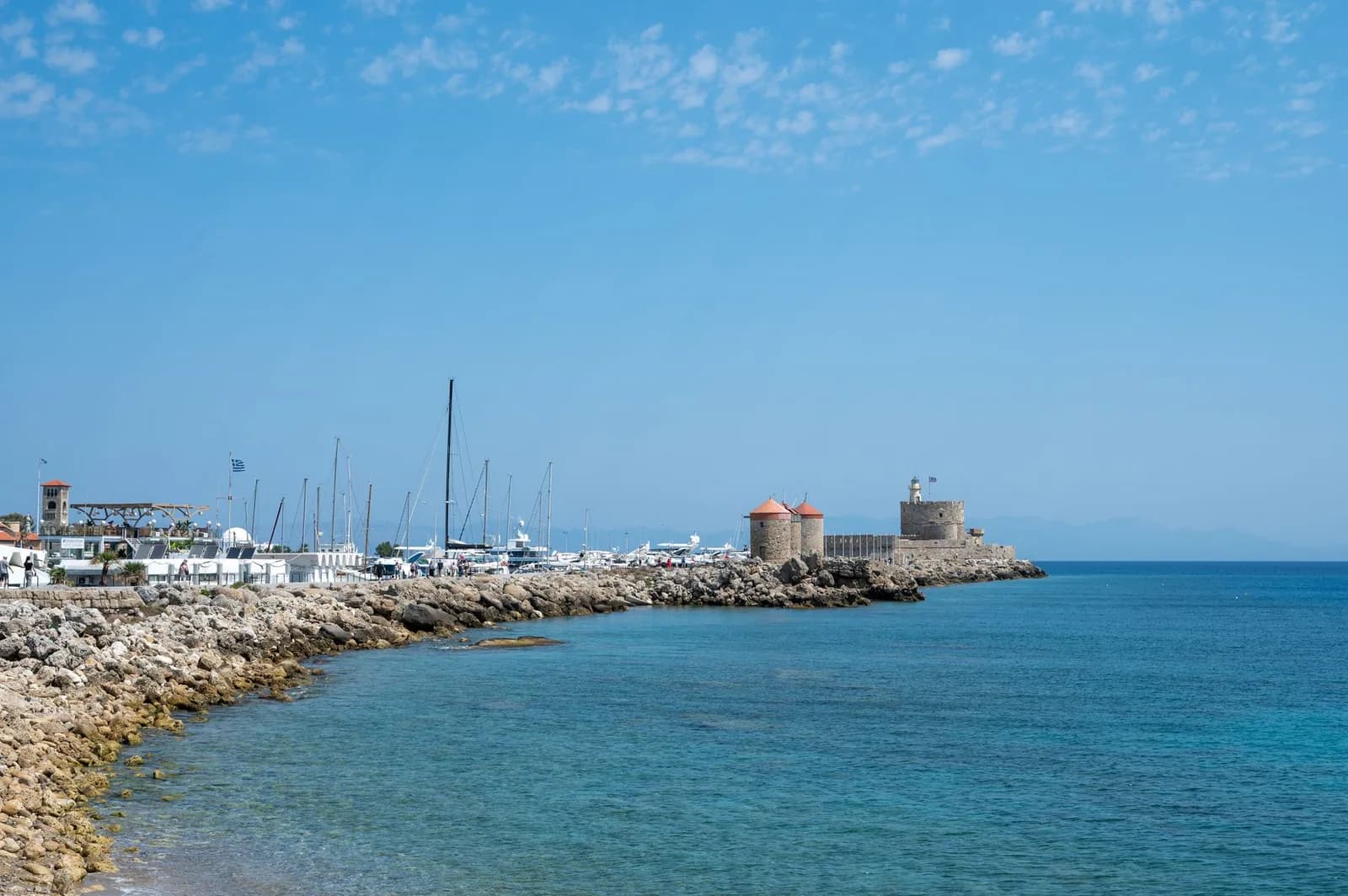
Rhodes map: where everything is on the island
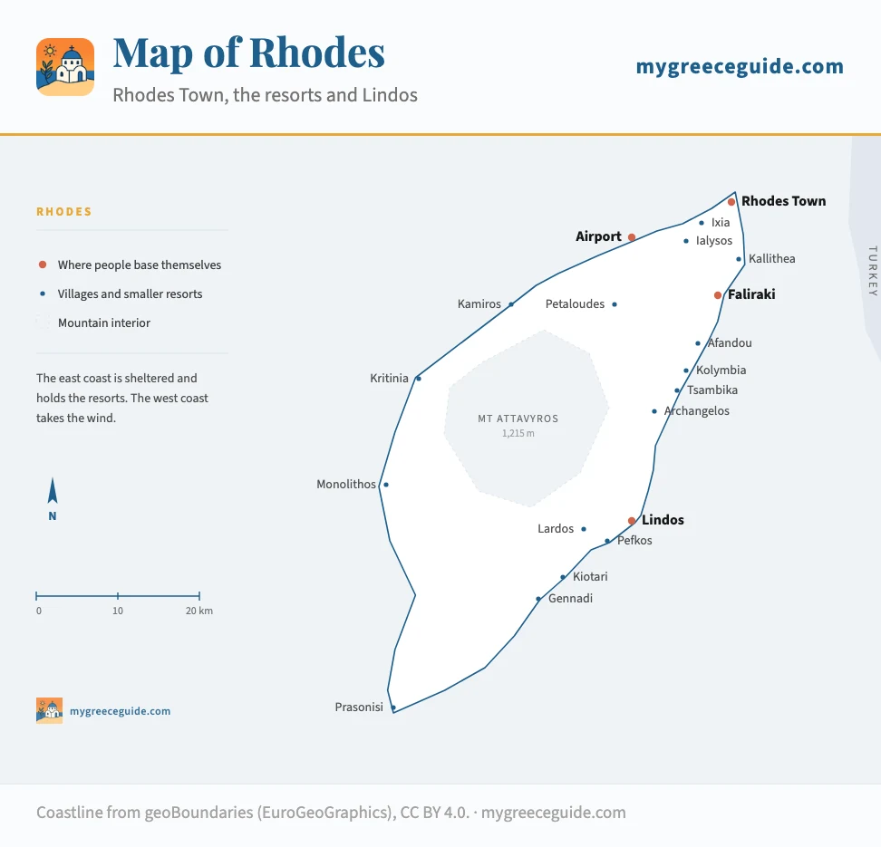
Rhodes is 80 km long, and almost every booking mistake made here comes from not knowing that. Lindos is 55 minutes from the airport, not ten. The Old Town has four gates and only one of them puts you where you meant to be.
The island runs north-east to south-west, with Rhodes Town and the airport at the northern tip and almost nothing at the southern one. The east coast is sheltered and holds the resorts. The west coast takes the wind, which is why it has kitesurfers instead of sunbeds. Everything below is placed from its real coordinates.
The island
Where the resorts are, and who each one suits
The resorts are strung along the east coast in a rough order: nightlife closest to Rhodes Town, families in the middle, quiet at the far south. Because the island is 80 km long, the resort you pick decides how much of your week is spent in a car, and what each stretch of coast costs to sleep on follows much the same north to south gradient.
Choose the profile to get the right side of Rhodes
Who is the trip for?
You want sand rather than shingle, a short transfer, and somewhere you can walk to dinner without the car.
Kolymbia
East coast, 25 km south of Rhodes Town
- Airport
- 40 min
- Old Town
- 30 min
A long shelving beach and a single main street of tavernas. Nothing happens after eleven, which is the point.
Kiotari
South-east coast, 18 km beyond Lindos
- Airport
- 1 h 15
- Old Town
- 1 h 10
Big beachfront hotels with very little around them. Good if you plan to stay put, frustrating if you do not have a car.
How far is everything, really
These are driving times outside July and August, when the coast road south of Faliraki slows down. Add roughly a third in high season.
| From | To | Distance | By car | Worth knowing |
|---|---|---|---|---|
| Airport | Rhodes Town | 14 km | 20 min | Bus every 30 min, or 25 € by taxi |
| Airport | Faliraki | 22 km | 30 min | Straight through Rhodes Town |
| Airport | Lindos | 55 km | 1 h 05 | The transfer most people underestimate |
| Rhodes Town | Faliraki | 14 km | 20 min | Frequent buses, easy without a car |
| Rhodes Town | Lindos | 47 km | 55 min | Coast road, one bus an hour |
| Rhodes Town | Prasonisi | 92 km | 1 h 45 | Day trip territory, not a beach run |
| Lindos | Pefkos | 5 km | 10 min | Walkable in 45 min along the road |
| Lindos | Kiotari | 18 km | 25 min | Quiet stretch of the south-east coast |
| Rhodes Town | Monolithos | 72 km | 1 h 20 | West coast, via the inland road |
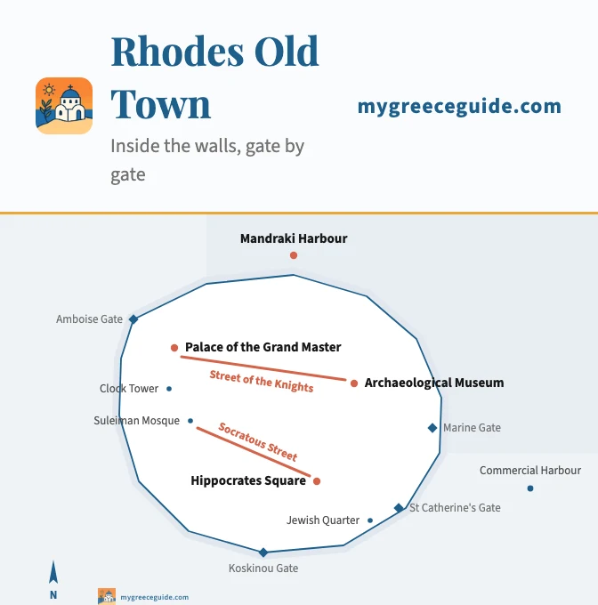
Rhodes Old Town map
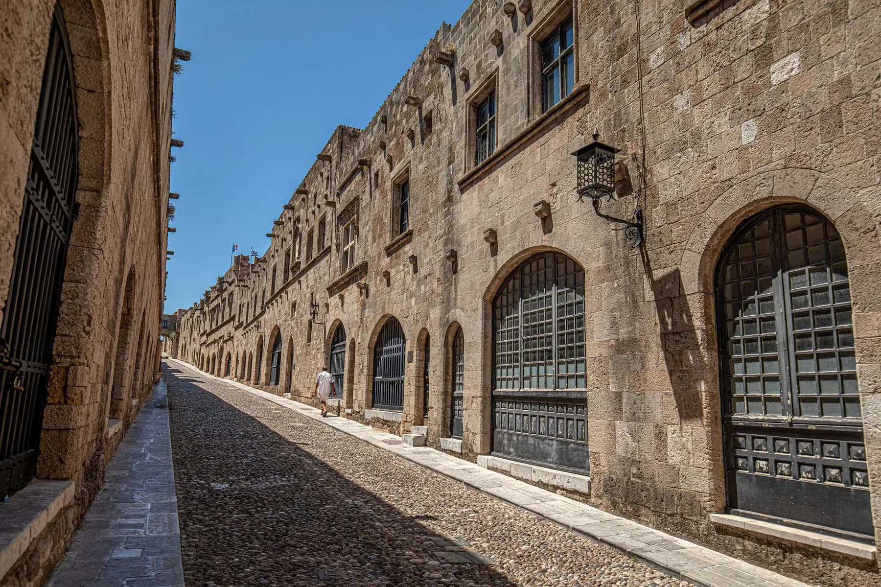
The Old Town is the largest inhabited medieval town in Europe, and it is genuinely easy to get lost in. Two streets do most of the orientation work: the Street of the Knights, which runs east from the Palace of the Grand Master, and Socratous, which climbs from Hippocrates Square to the Suleiman Mosque. If you can find either, you know where you are.
Inside the walls
Cruise passengers land at the commercial harbour and walk in through the Marine Gate, which is why the eastern half is solid between eleven and four. The lanes north of the Street of the Knights stay quiet all day.
The line to find
Lindos map
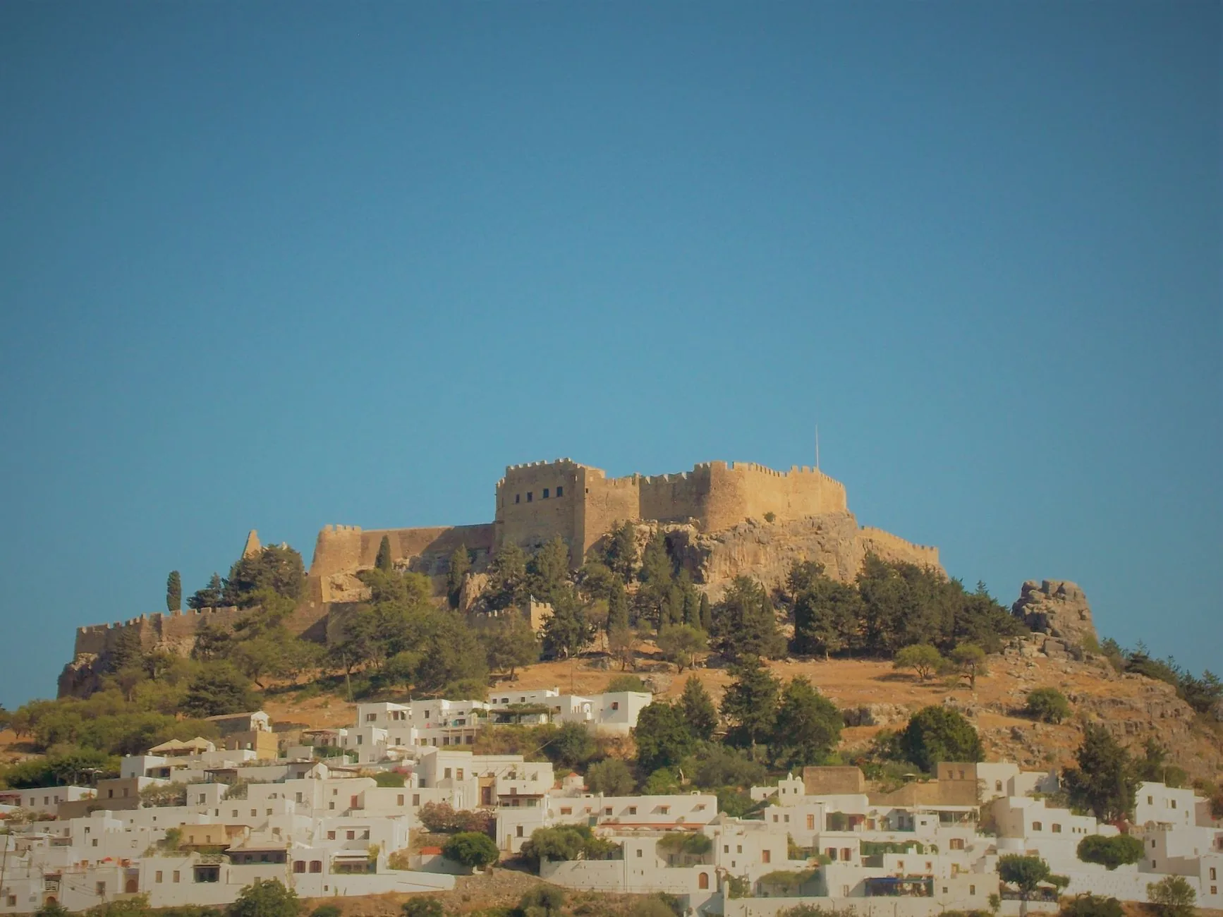
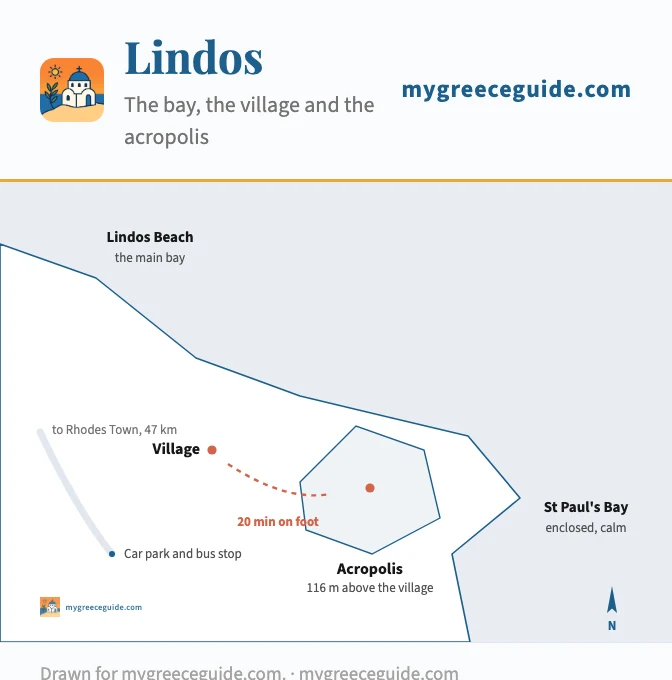
Lindos is three things stacked together: a beach, a village of white cube houses, and an acropolis on the rock above them. Cars stop at the car park above the village, so the last part is on foot whatever you arrive in.
The three layers
Lindos
Getting around: bus or car
Two bus companies split the island from Rhodes Town. KTEL Rhodes covers the east coast down to Lindos and Gennadi, roughly hourly in summer and far less often out of season. RODA runs the town and the near north. The buses are reliable on the east coast and thin everywhere else, so the west coast, the inland villages and Prasonisi are effectively car territory.
If you are staying in Rhodes Town or Faliraki and only want the beach, skip the car. If Lindos, Monolithos or the south is on the list, take one for the days you need it rather than the whole week: parking inside the walls is not possible, and hotels on the east coast charge for it.
Where is Rhodes, exactly
Rhodes is the largest of a chain of a dozen inhabited islands that follows the Turkish coastline down the eastern edge of the Aegean. It sits about 18 km off Turkey and 430 km from Athens, which is why the flight from Athens takes an hour and the ferry takes overnight. On a map of Europe, look at the bottom right corner of the Aegean, almost level with Antalya. If the chain itself is what is confusing you, which chain each island belongs to is set out separately, and the group map draws the boats across to Marmaris and Fethiye alongside the Greek ones.
Kos is the obvious second stop, 100 km north-west up the same chain and reachable by fast ferry in about two and a half hours. It is half the length of Rhodes and, apart from one ridge, flat, which is why people cycle there and drive here, so it is worth a look at how the smaller island is arranged before you decide which of the two takes the longer half of a trip. Note that if you fly in or out of it, its runway sits well inland at Antimachia, roughly halfway along the island rather than beside the town, which is not how Rhodes works.
That position is the reason the Knights of St John fortified it, the reason the Ottomans wanted it, and the reason the Italians held it for thirty years. All three left their buildings inside the walls, and that is what you walk through in the Old Town today. If you want a guide for the acropolis or the Street of the Knights, book before you fly in July and August: the morning slots go first, and the afternoon ones put you on the rock at 35 degrees.
Questions people ask about Rhodes
Is Rhodes a Greek or Turkish island?
Rhodes is Greek, and has been continuously since 1948. The confusion is geographic rather than political: the island sits about 18 km off the Turkish coast, far closer to Marmaris than to Athens, which is 430 km away. It belongs to the Dodecanese, the chain that runs along the Turkish shoreline. Ferries cross to Marmaris and Fethiye in under two hours, so it is common to see Turkey from the beach.
What is the nicest area in Rhodes?
It depends what you came for, and the island is long enough that the answer matters. Lindos and Pefkos have the setting on the east coast. Faliraki has the nightlife. Kolymbia and Kiotari suit families who want sand and quiet. The west coast around Monolithos is windier and emptier, which is either the appeal or the problem. Rhodes Town is the only base where you do not need a car.
What is Rhodes famous for?
Three things, in the order visitors meet them. The medieval Old Town, the largest inhabited medieval town in Europe and a UNESCO site since 1988. The acropolis at Lindos, on a rock 116 m above the village. And the Colossus, one of the seven wonders of the ancient world, which stood near the harbour for 54 years until an earthquake brought it down in 226 BC. Nothing of it remains.
Which is nicer, Crete or Rhodes?
Crete is roughly ten times larger, so it holds mountains, gorges and several genuinely different regions. Rhodes is small enough to cross in an hour and a half, which makes it far easier on a one week trip. If you want one base and no long drives, Rhodes wins. If you want variety and are prepared to move around, Crete does.
