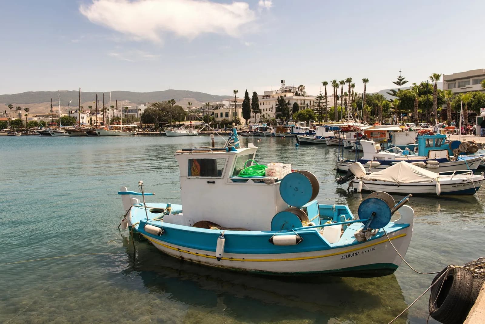
Kos map: where everything is on the island
Kos is 45 km long and, with one exception at the eastern end, flat. That is the whole island in a sentence, and it decides more about a trip here than any hotel review does.
The island lies on a diagonal, with Kos Town and its ferry port at the north-eastern end, the airport in the middle, and the Kefalos headland trailing off to the south-west. Sandy shallow beaches run along the north coast. The big package hotels are on the south. The only high ground is the Dikeos ridge, which sits behind Kos Town and nowhere else. Every label on the maps below comes from the place's real coordinates, not from a sketch.
The island
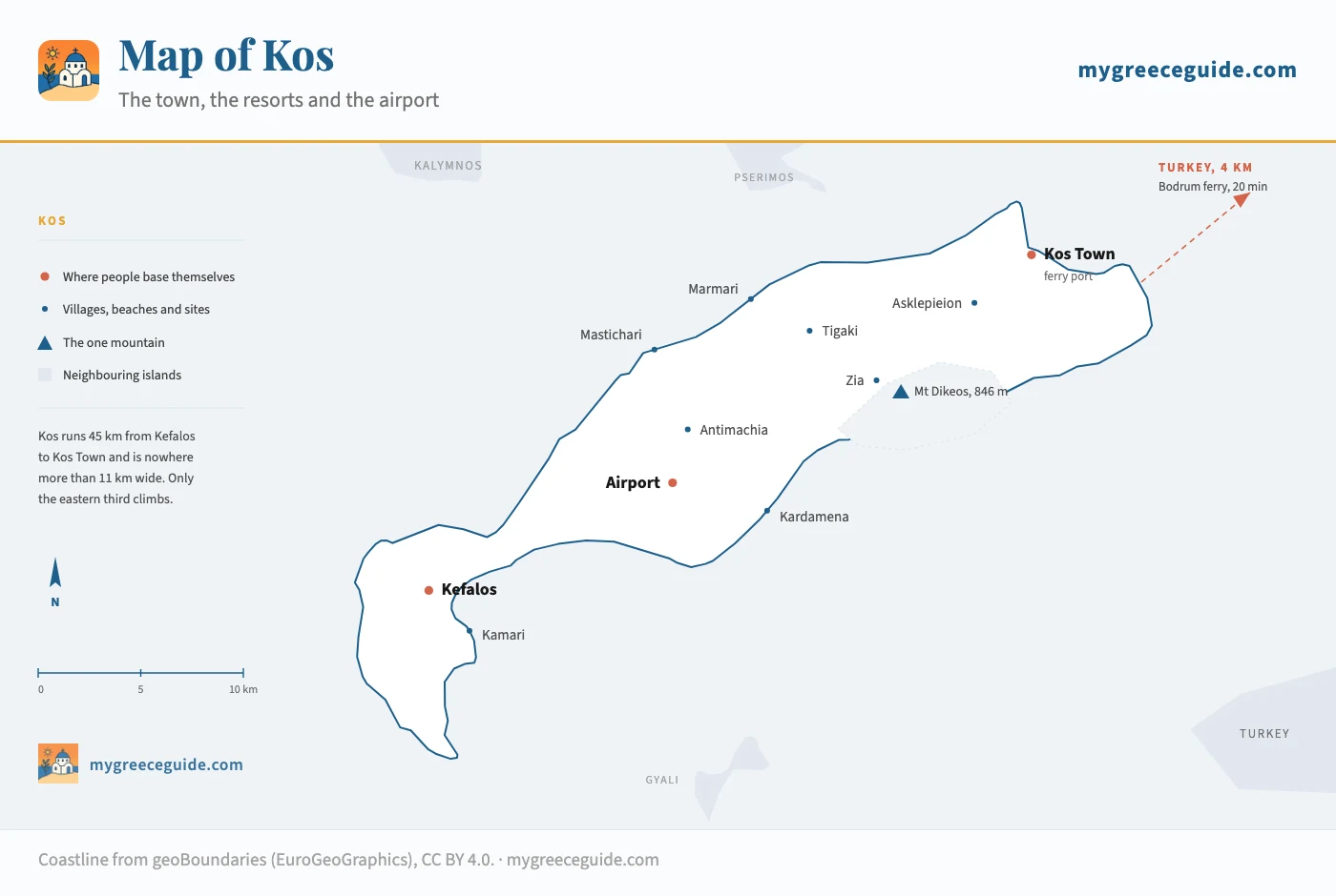
Where the towns and resorts sit
There are five places people actually stay, and they sit on one line. Pick the one you are considering and the map above stops being an abstraction.
Where are you thinking of staying?
Distance from Kos Town
Kos Town
North-eastern end, around the harbour
- Airport
- 30 min
- Kos Town
- on the spot
The only base where the ruins, the ferries, the restaurants and the nightlife are all within walking distance. The town beaches are narrow, so people ride ten minutes to Lambi or Psalidi for the sand.
On a bike
Bike lanes run through the town and along the seafront in both directions, out to Lambi one way and Psalidi the other. Almost nobody here rents a car.
Once the base is settled, the hotels worth booking in each of these areas are listed area by area, with how far a rented bike gets you from every one.
How far everything is, by car and by bike
Driving times are outside July and August, when the road through Zipari backs up in the mornings. Cycling times assume 15 km/h, which is what a rented town bike does with a towel on the rack and no wind against it. One line in the table catches people out: the runway is 24 km out at Antimachia, near enough the middle of the island, so nowhere is far from it and nowhere is next to it either.
| From | To | Distance | By car | By bike | Worth knowing |
|---|---|---|---|---|---|
| Airport | Kos Town | 24 km | 30 min | not advisable | Main island road, no shoulder to speak of |
| Airport | Mastichari | 6 km | 10 min | 25 min | Shortest transfer on the island |
| Airport | Kardamena | 8 km | 12 min | 35 min | Downhill to the coast, uphill coming back |
| Airport | Kefalos | 18 km | 25 min | 1 h 15 | Climbs over the Kefalos headland |
| Kos Town | Asklepieion | 4 km | 10 min | 20 min | Gentle rise, cycle path most of the way |
| Kos Town | Tigaki | 12 km | 15 min | 45 min | Flat coast road, the classic first ride |
| Kos Town | Marmari | 16 km | 20 min | 1 h | Same road, four kilometres further on |
| Kos Town | Zia | 15 km | 25 min | 1 h 30 | 350 m of climbing, the one hard ride |
| Kos Town | Kardamena | 30 km | 35 min | 2 h | Crosses the island to the south coast |
| Kos Town | Kefalos | 43 km | 50 min | 3 h | End to end, and the furthest you can go |
| Tigaki | Marmari | 5 km | 8 min | 20 min | Along the back of the salt lake |
The bike column is the part no other map of Kos bothers with, and it is the reason the island reads differently from Rhodes or Crete. Kos Town has separated bike lanes on its main streets and a seafront path running west to Lambi and east to Psalidi, and the coast road to Tigaki carries a stream of bicycles all summer. Rental costs about 8 euros a day from the shops around Eleftherias Square, and roughly half that by the week.
Why the bike column exists
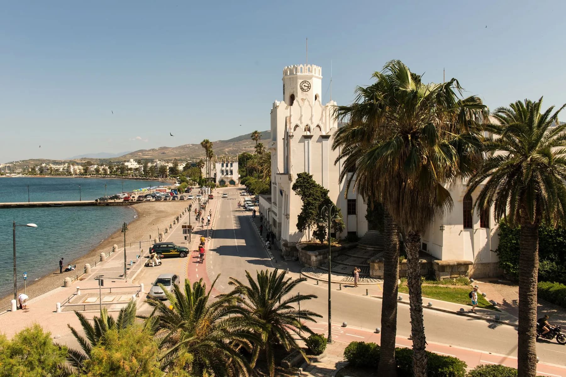
Where it breaks down is the main island road. Once you are past Marmari, the route west runs inland, carries airport traffic and has no shoulder, so the far half of Kos is not somewhere to be on two wheels. If Kefalos or Kardamena is on the list, that is a car day.
Kos Town map
Kos Town is small and unusually legible for a Greek port. The harbour is the reference point: the ferries and the Bodrum boats leave from its western quay, the Castle of Neratzia occupies the promontory on the eastern side, and almost everything worth seeing is within a ten minute walk south of the water.
The town
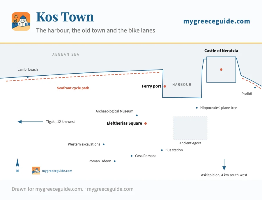
The plane tree in Platanou Square is the one everybody photographs, on the claim that Hippocrates taught under it. The tree is roughly 500 years old and he died around 370 BC, so the arithmetic does not work, but the square is still the hinge of the town: the castle bridge on one side, the mosque on the other, the ancient agora spreading out behind it towards Eleftherias Square. The agora is open ground you walk through rather than a site you queue for.
The Asklepieion is the exception to the ten minute rule. It sits 4 km south-west of town on three terraces cut into the hillside, high enough that the Turkish coast fills the horizon behind it. Buses run there, and so does the little tourist train, but 20 minutes on a bike up a gentle rise is the pleasant way to arrive.
The one hill: Zia and Mount Dikeos
Everything said so far about flat ground stops at the Dikeos ridge, which runs along the eastern third of the island and tops out at 846 m. Zia sits on its northern slope at about 350 m, a village of stone houses and tavernas that exists in its current form largely because the sunset view over Kalymnos is worth the drive up.
Three hundred and fifty metres up
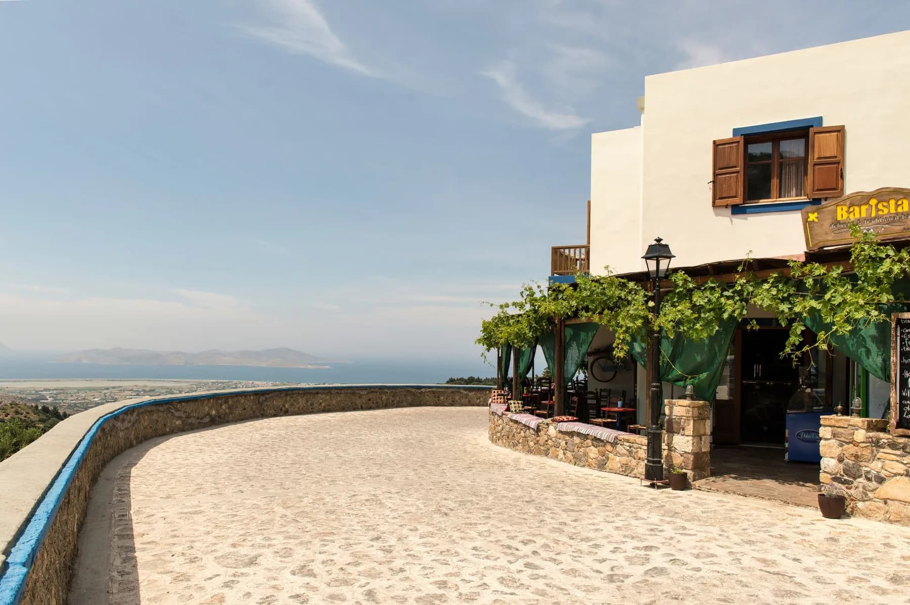
Go late in the day and expect company: the coaches arrive from the resorts around six. Come up in the morning instead and Zia is a quiet place to start the walk to the summit, which takes about two and a half hours from the village and is the only proper hike on Kos. Higher up you can see Kalymnos, Pserimos, Nisyros and the whole Turkish coastline in one turn.
Where Kos is, and how close Turkey really is
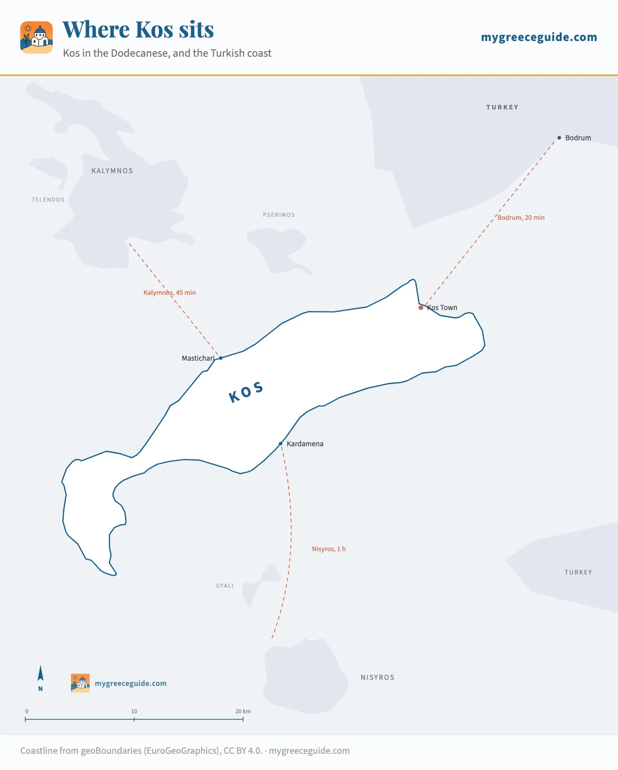
Kos is the third largest of the chain most visitors reach through Rhodes or through here, which runs down the Turkish coast along the eastern edge of the Aegean. Rhodes is 100 km south-east, Athens 320 km north-west, and the Turkish shore about 4 km off the north-eastern tip. That last number is the one that surprises people: from the beach at Psalidi you are looking at Turkey, not at another Greek island. The Dodecanese is one of six island groups in Greece, and seeing how the chains divide up the Aegean makes the position of Kos far easier to hold in your head.
The neighbourhood
The crossing to Bodrum takes twenty minutes from Kos Town harbour, which makes it the shortest hop between Greece and Turkey anywhere in the Aegean. Boats also run to Kalymnos, to Pserimos and its single beach, and south to the volcano on Nisyros. Coastline from geoBoundaries (EuroGeoGraphics), CC BY 4.0; the Turkish shore is drawn schematically.
That position explains the rest of the island. The Knights of St John built the castle at the harbour mouth because Kos guards the approach to Bodrum, which they also held. The Italians ran the island for thirty-three years and left the grid of avenues and the administrative buildings around Eleftherias Square. Both are still what you walk through in the town today. Kos is not the only island here with a boat to the far shore either: the group map draws all six crossings to Turkey and the distances they cover.
Rhodes, 100 km down the same chain, is the island most people pair with Kos, and it works on a completely different scale: 80 km long against 45, with the resorts strung out along one coast rather than gathered around a single town. That changes the planning entirely, so it is worth seeing how the larger island is laid out before you assume a week there works the way a week here does. In particular the base you choose carries far more weight, because a bad guess can put you 55 minutes from everything you came for, which is why picking a resort to sleep in over there deserves more thought than it usually gets.
Day trips to Bodrum are easy and worth doing, though take your passport and remember it is a border crossing with the paperwork that implies. If you would rather stay put, the Asklepieion is the site that rewards having someone explain it, because almost nothing on those three terraces is signposted in a way that tells you what you are looking at.
Questions people ask about Kos
Which is the nicest part of Kos?
It depends on how far you are willing to travel for dinner. Kos Town has the ruins, the harbour and the only nightlife you can walk home from. Tigaki and Marmari have the shallow sandy beaches and the flattest cycling on the island. Kefalos, at the far south-western tip, has the best scenery and the worst logistics: it is 43 km from town and everything around it is a climb. Zia, up on the Dikeos ridge, is where the island stops looking like a beach resort.
Is Kos a Greek or Turkish island?
Kos is Greek, and has been since 1948, when Italy handed the Dodecanese to Greece. The confusion comes from the map rather than the politics. The Turkish coast sits about 4 km off the north-eastern shore, and Bodrum is a twenty minute ferry from Kos Town harbour, while Athens is 320 km away. You can read the buildings on the Turkish hills from the beach at Psalidi.
What is Kos best known for?
Hippocrates, who was born here around 460 BC and gave his name to the plane tree in the middle of Kos Town. The Asklepieion, the healing sanctuary on the terraces 4 km outside town, is the site that follows from him. After that it is the beaches on the north coast, the Castle of Neratzia at the harbour mouth, and a network of bike lanes that no other Greek island of this size has.
Which Greek island is closest to Kos?
Pserimos, a speck of an island with one beach and about thirty residents, sits in the channel between Kos and Kalymnos and is reached by day boat in under an hour. Kalymnos itself is the nearest inhabited island of any size: ferries from Mastichari cross in about twenty minutes and from Kos Town in forty-five. Nisyros, the volcano, is an hour south from Kardamena.
Where are the beaches on a map of Kos?
They split cleanly by coast, and the map explains why. The north coast, from Lambi through Tigaki to Marmari, is shallow, sandy and flat enough to reach by bike from Kos Town in 20 to 40 minutes, which is where most families end up. The south coast holds the big package beaches, Kardamena and Paradise, which are deeper and windier. The far south-west around Kefalos has the best sand on the island, Agios Stefanos and Camel Beach among it, and is 43 km from town, so it is a driving day. Psalidi, immediately east of town, is pebble rather than sand and looks straight at Turkey.
